
Forecast Highlights
Forecast
Prepare to dodge spotty afternoon rainfall! A weak disturbance, combined with some added moisture in the atmosphere, should bring isolated pop-up showers later today. The chance of rain stands at 20%, with slightly higher odds expected in areas south and east of San Antonio. Looking ahead, Thursday presents our best opportunity for downpours, with a 30% chance of rain.
Future radar at 4pm Wednesday (9/9). Spotty rainfall is possible today.
(Copyright 2026 by KSAT – All rights reserved.)
Despite the rain chances, the heat in San Antonio persists. Just yesterday, the city reached its 19th day with temperatures at or above 100°F. As we move forward, upper-90s will be the norm, but a few days may see temperatures briefly touch the 100°F mark again.
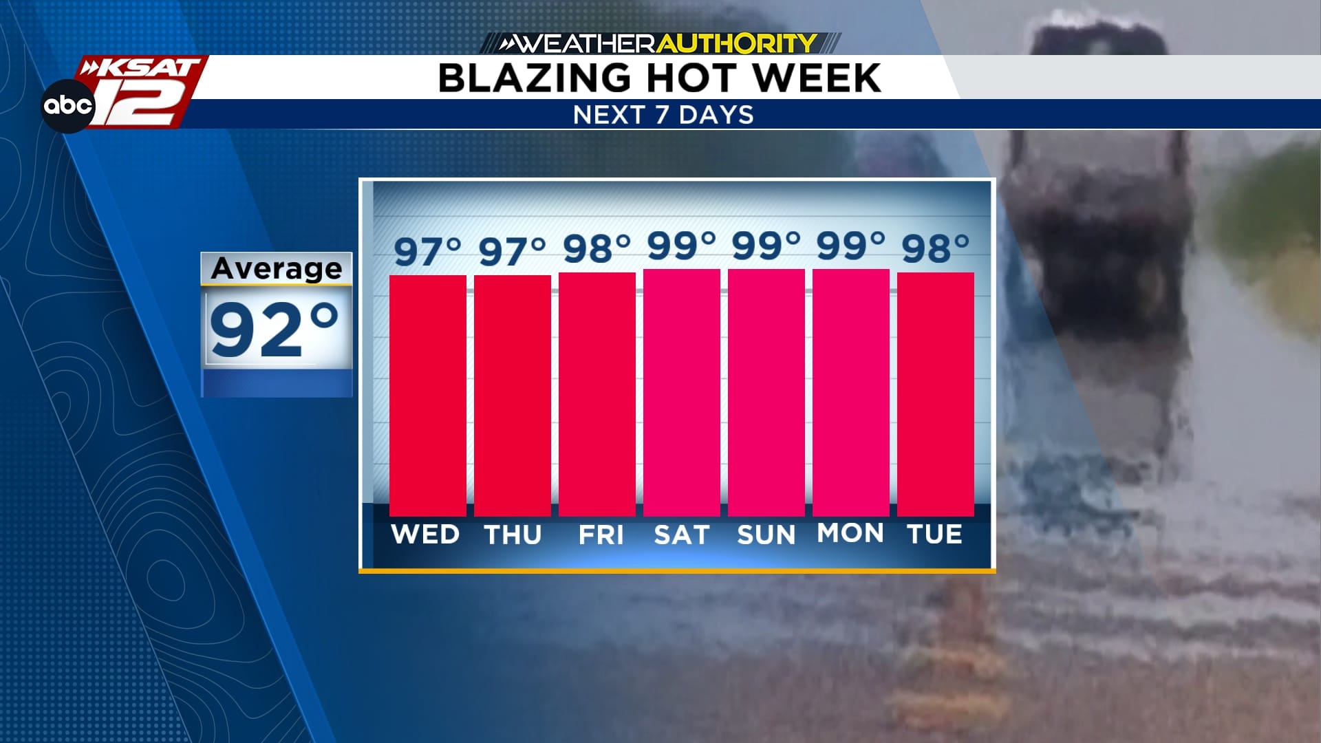
Upper-90s will be the norm going forward, however, San Antonio could briefly touch 100 by the weekend.
(Copyright KSAT-12 2026 – All Rights Reserved)
On another note, the Atlantic Ocean is surprisingly quiet as we approach the peak of hurricane season on September 10th. This calm is largely attributed to El Niño, which appears to be keeping tropical activity to a minimum. In fact, this season might set the record for the latest first hurricane, should one eventually form.
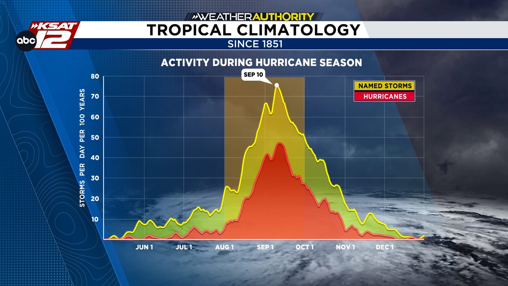
Tropical climatology. Atlantic hurricane season peaks on Thursday.
(Copyright KSAT-12 2026 – All Rights Reserved)
