
FORECAST HIGHLIGHTS
FORECAST
THIS WEEKEND
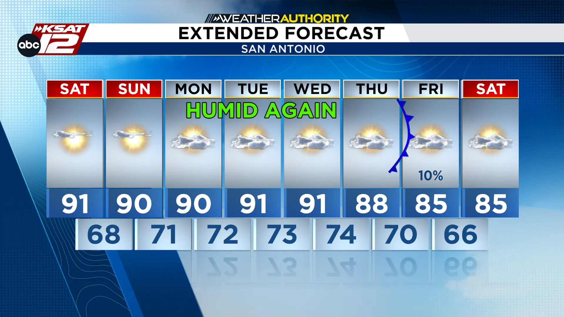
If you’re in South Texas, get ready for a stunning weekend filled with sunshine and low humidity! Mornings will feel comfortable, perfect for outdoor activities. As the day progresses, expect temperatures to rise into the upper 80s in the northern regions and mid-90s in the southern areas. Although winds will gradually shift to the southeast later today, it won’t drastically change conditions, keeping your weekend plans mostly dry.
Extended Forecast (Copyright KSAT-12 2026 – All Rights Reserved)
As we move into Sunday, the sunny and warm weather continues, with highs again in the upper 80s to mid-90s. However, expect humidity levels to gradually rise overnight, signaling a shift toward warmer, more humid conditions as the new workweek begins. Don’t worry, though—rain is not expected to interrupt your weekend fun.
Hot and Increasingly Humid
Starting Monday, get ready for a noticeable increase in humidity and warmer mornings. Afternoon heat index values could soar over 100 degrees, especially in areas east of I-35, where isolated showers might pop up. Still, the main concern will be those hot, muggy days stretching through mid-week.
As the week progresses, rain chances might begin to rise over the Edwards Plateau by late Wednesday, indicating a changing weather pattern. However, the exact timing and coverage of any potential showers and storms remain uncertain.
Extended Forecast (Copyright KSAT-12 2026 – All Rights Reserved)
POSSIBLE COLD FRONT?
Looking ahead to late next week, a change in the weather pattern could bring scattered showers and thunderstorms. There’s a possibility that a cold front may approach South Texas, but the exact timing and how it will affect temperatures is still up in the air.

