
FORECAST HIGHLIGHTS
FORECAST
TODAY/THURSDAY
Today calls for more heat and humidity, however, a lucky few may see an afternoon downpour. Rain chances in San Antonio sit at 20%. Otherwise, expect partly cloudy skies and highs in the low-90s. Heat index values will rise into the upper-90s.
On Thursday, a few storms will be possible along the Rio Grande and Edwards Plateau. San Antonio is forecast to stay quiet and warm.
Future radar for 5pm today (10/14) (Copyright KSAT-12 2026 – All Rights Reserved)
PREPARE FOR A BIG CHANGE FRIDAY
Just before sunrise, a cold front will sweep through San Antonio. A few brief showers are possible as the front slides through. It will then turn windy, with gusts of up to 35 mph possible throughout the day. You’ll want to remember to secure those Halloween decorations! Meantime, temperatures will dip into the mid-60s Friday morning, before rebounding into the low-70s by the afternoon.
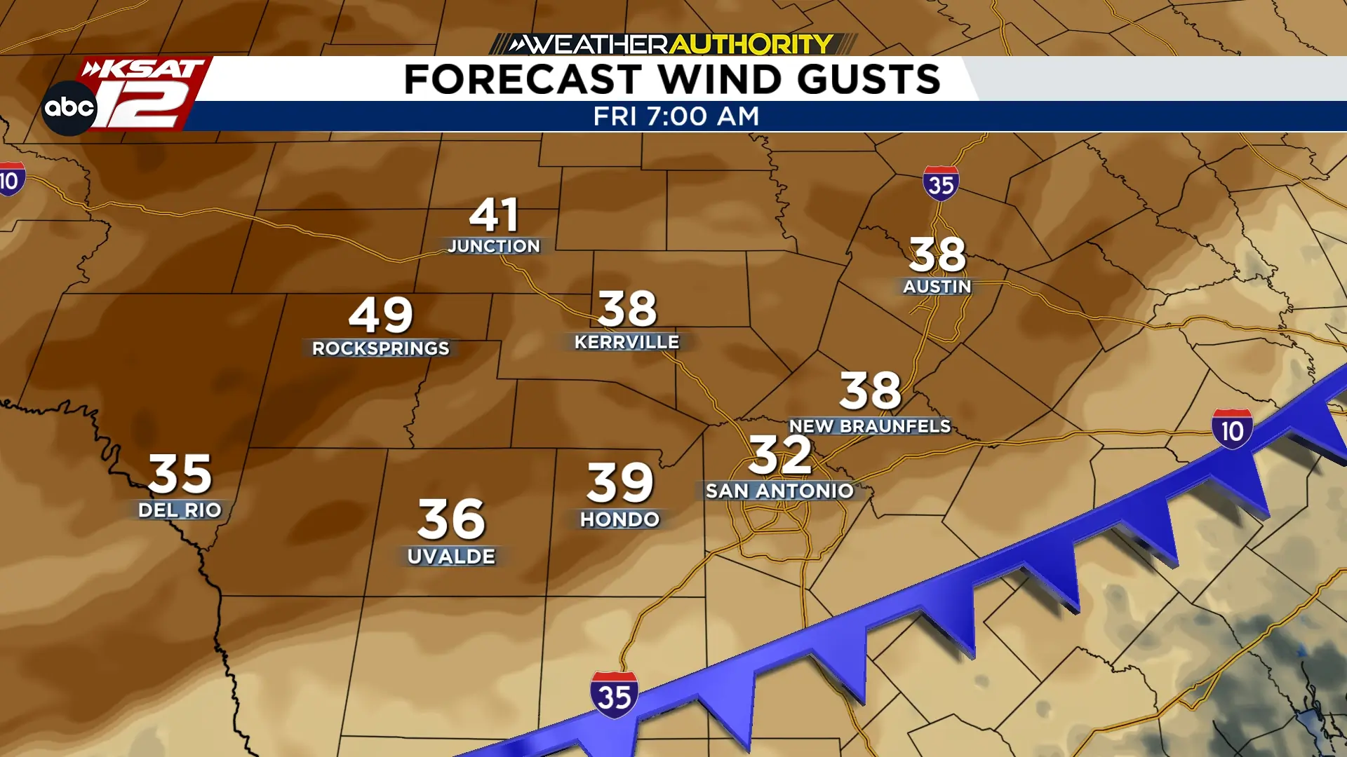 Gusty winds will kick in behind an early morning front on Friday (10/16) (Copyright KSAT-12 2026 – All Rights Reserved)
BEAUTIFUL WEEKEND
Both Saturday and Sunday mornings will start in the low-50s. The Hill Country is forecast to fall in the 40s. The afternoons will be beautiful! Expect highs in the 70s, under mostly sunny skies.

