
FORECAST HIGHLIGHTS
FORECAST
TODAY
Summer-like heat continues across South Central Texas through late September, with Sunday highs in the mid-90s to near 100°.
Isolated evening storms are possible in the Hill Country and southern Edwards Plateau, though rain chances remain low at 30%. While severe weather is not expected, any storms could bring gusty winds and localized heavy rain.
Futurecast at 10:45 pm Sunday evening (Copyright KSAT-12 2026 – All Rights Reserved)
MORE RAIN CHANCES
A stalling front and lingering moisture may spark isolated showers or storms Monday afternoon and evening, with scattered activity possible through Wednesday. With rain chances capped at 20-30%, most areas will remain dry.
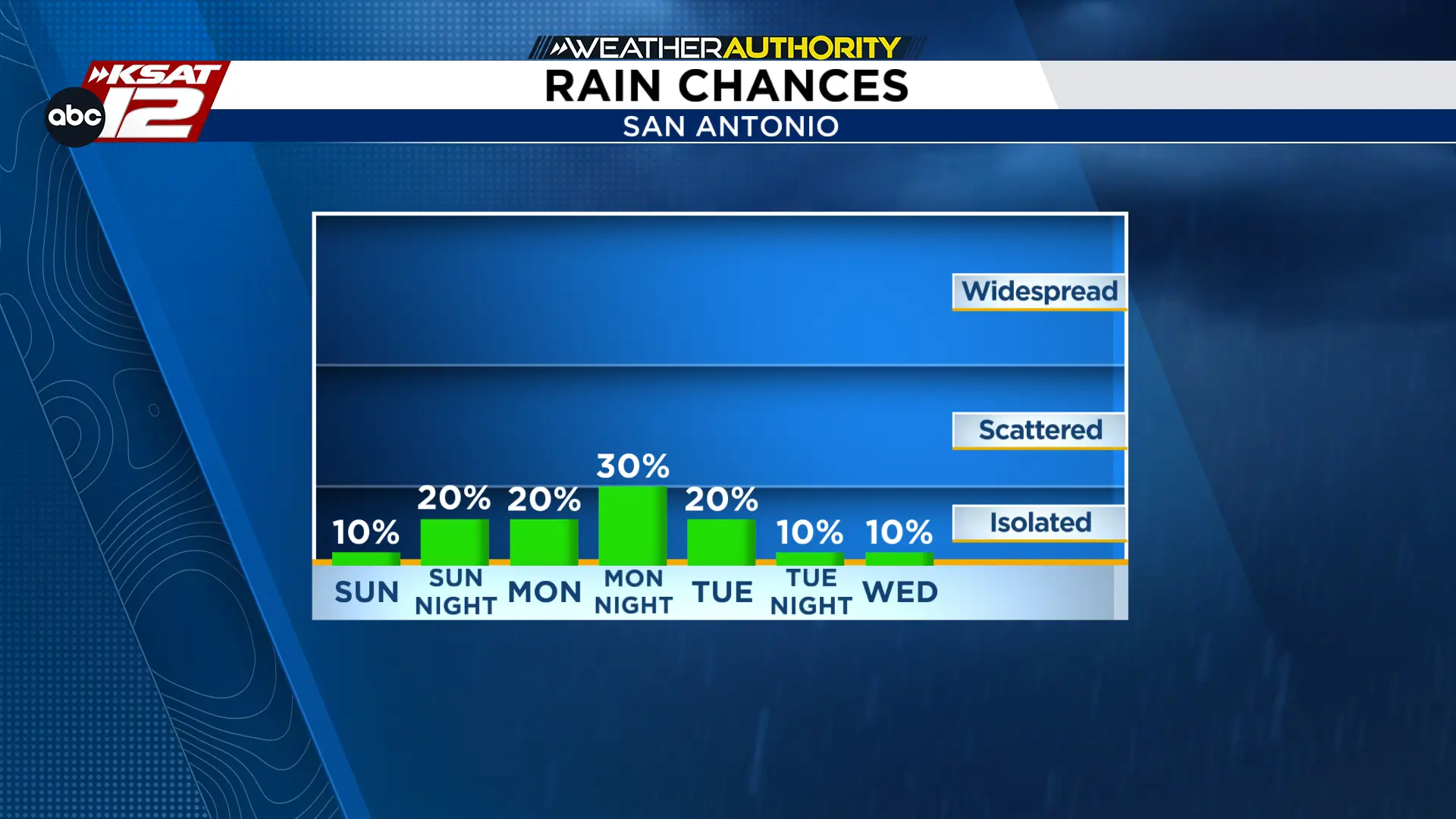 Rain chances for the start of the week. (Copyright KSAT-12 2026 – All Rights Reserved)
THIS WEEK
High pressure will keep South Central Texas hot and mostly dry through the week. Expect spotty rain chances through Wednesday, followed by a slight cooling trend later in the week with highs in the low-to-mid 90s. While temperatures will remain above average, drier air may bring cooler nights by the weekend.

