
As we step into a new day, weather conditions are shifting in the San Antonio area. This morning, storms are making their way across the region from the west. While these storms are currently weakening, it’s important to note that they may dissipate before reaching San Antonio. Rest assured, meteorologists will continue to monitor the situation closely.
Later Today
This afternoon, we anticipate a resurgence of storms along a frontal boundary stretching across the Edwards Plateau and the Rio Grande. These storms have the potential to become strong to severe, with hail and gusty winds posing the primary threats. There’s a possibility that these storms could reach San Antonio this evening and into the night.
Severe risk today (9/30)
(Copyright KSAT-12 2026 – All Rights Reserved)
Heavy Rain Thursday
Looking ahead to Thursday, we see an even better chance for rain as a slow-moving front approaches the I-35 corridor. The atmosphere is rich in moisture, meaning any storms that develop could deliver heavy rainfall. Urban areas may experience street flooding, and we will closely monitor local creeks and streams.
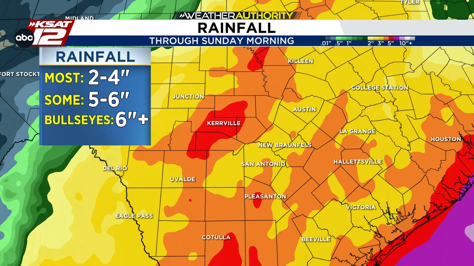
Widespread rainfall totals of 2-4″ is forecast through Friday
(Copyright KSAT-12 2026 – All Rights Reserved)
Rain Lingers on Friday
As we move into Thursday night, the front is expected to push south and east of San Antonio. However, rain could still linger into Friday. While not as intense, any additional rainfall could still contribute to flooding concerns.

