
FORECAST HIGHLIGHTS
FORECAST
TODAY
South Texas remains under a Heat Advisory today from noon to 7 p.m., with heat index values climbing to 108°. Expect highs near 100° and a slim chance of isolated afternoon storms near the Coastal Plains and San Antonio.
The heat remains the dominant story (Copyright KSAT-12 2026 – All Rights Reserved)
NEXT WEEK
Unfortunately, cooler weather isn’t showing up anytime soon. Very little change is expected Monday as High pressure will continue to dominate the region, maintaining a pattern of hot, mostly dry weather. High temperatures should stay in the mid-90s to just above 100° each afternoon.
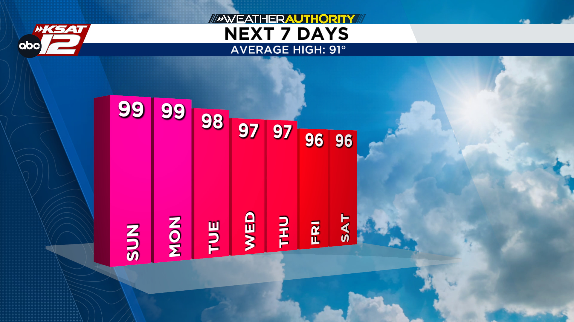
Near-record heat possible, with some areas approaching 100° or higher. (Copyright KSAT-12 2026 – All Rights Reserved)
The Coastal Plains will have the best chance for rain, with daily sea-breeze showers and thunderstorms possible during the afternoon and evening. While most inland areas remain dry, isolated storms may develop near the coast as the day progresses.
A POTENTIAL PATTERN CHANGE?
There may finally be some hope toward the end of NEXT WEEKEND. Forecast models are hinting at a possible pattern shift that could bring temperatures back below 100° and increase rain chances across the region. However, there is still disagreement. For now, the heat remains the dominant story, but this is something we’ll be watching closely as we get closer.
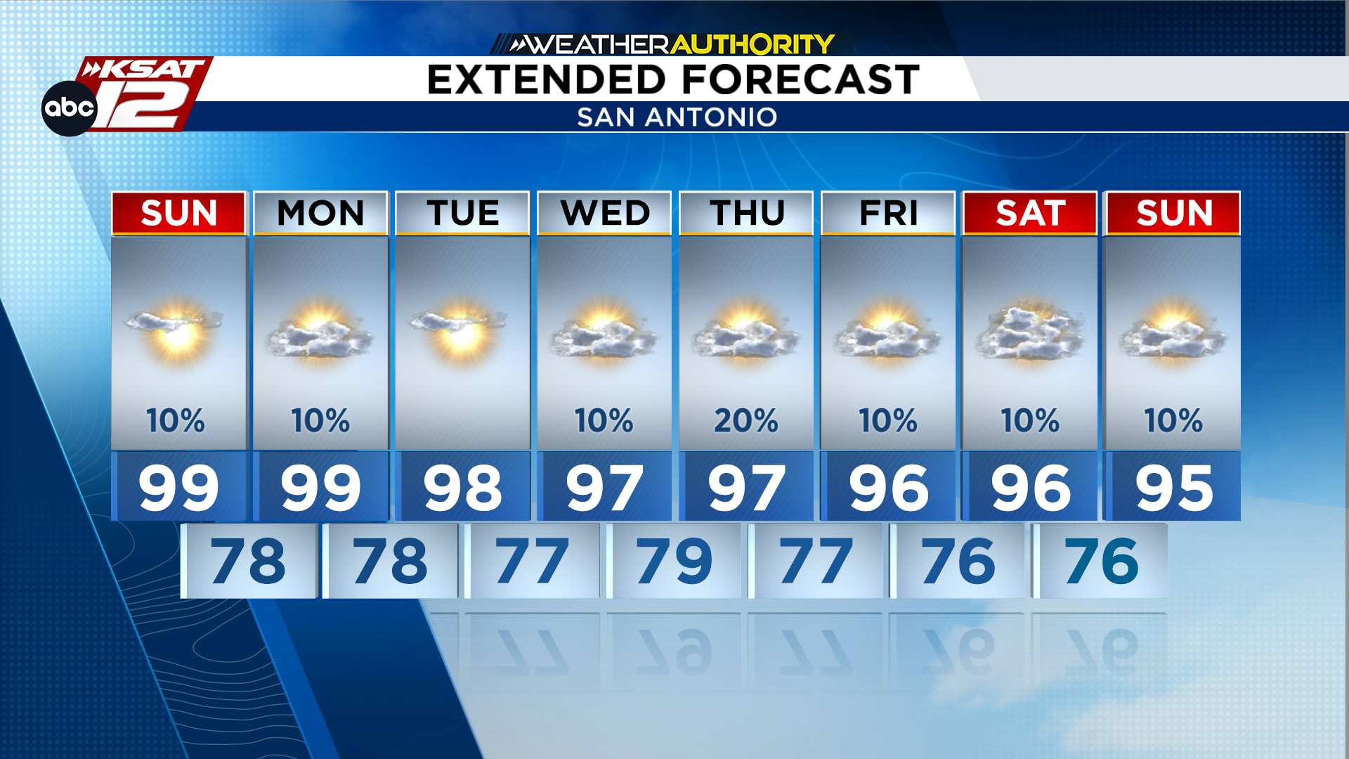
Extended Forecast (Copyright KSAT-12 2026 – All Rights Reserved)
