
FORECAST HIGHLIGHTS
FORECAST
HUMIDITY IS BACK
Humidity has surged back into South Texas, signaling a noticeable change in the weather. As we move through the day, not only will temperatures reach the low-90s, but the humidity will also make it feel quite sticky. This afternoon, the heat index values are expected to surpass 100°, making it crucial for residents to stay hydrated and take necessary precautions against heat-related illnesses. A stray shower or storm may pop up, particularly east of I-35, providing a brief respite from the heat for some areas.
HOT TEMPS
The heat isn’t going anywhere; in fact, temperatures are expected to climb even higher on Tuesday. Heat index values could approach 105°, emphasizing the importance of seeking shade and cooling off during peak hours. With the humidity levels remaining elevated, it is essential to monitor weather updates and prepare for a hot day ahead.
Forecast heat index for 4pm Tuesday (10/13) (Copyright KSAT-12 2026 – All Rights Reserved)
A LATE WEEK FRONT
Here’s the good news! A cold front is scheduled to arrive late Thursday into Friday. While this front may not bring significant moisture to San Antonio, it has the potential to unleash heavy rainfall along the Rio Grande as it sweeps through. For San Antonio, however, the rain chances are limited to about 10%. The more significant impact will be a noticeable drop in temperatures, with highs expected in the 70s and lows dipping into the 50s for the upcoming weekend. This shift will provide a refreshing change from the current heat wave, allowing residents to enjoy more comfortable outdoor activities.
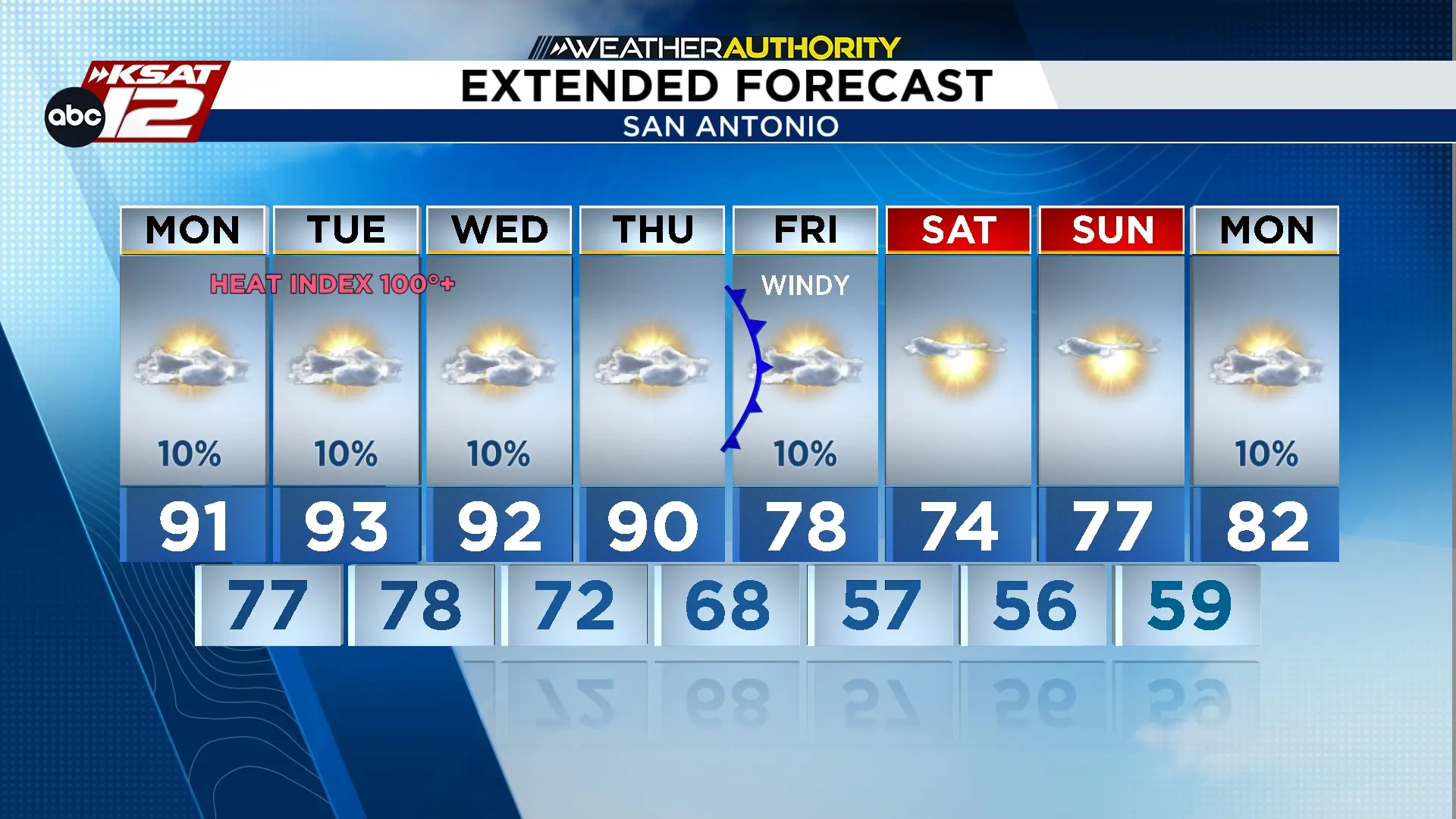 Extended Forecast (Copyright KSAT-12 2026 – All Rights Reserved)
