
FORECAST HIGHLIGHTS
FORECAST
This Thursday morning, residents are waking up to a chill in the air, but a significant warm-up is on the horizon. After sunrise, temperatures are expected to rise rapidly, reaching highs near 80°F under mostly sunny skies. However, as the day progresses, cloud cover may increase slightly before a cold front sweeps through the area overnight. Fortunately, with limited moisture expected, rain is not in the forecast.
As we transition into Friday, prepare for a windy and cooler day ahead. Gusty northwest winds will begin in the morning, with gusts potentially reaching up to 30 mph. Highs are forecasted to be in the 70s for most areas, providing a pleasant end to the work week, especially with lower humidity levels.
The weather will take a turn this weekend, starting Saturday. An upper-level low pressure system is expected to develop west of the area, leading to increased cloudiness. Showers are anticipated to begin by Saturday afternoon, with rain becoming likely by Saturday night. Rain chances will persist into Sunday morning, gradually tapering off by the afternoon. Due to the cloud cover and precipitation, temperatures are projected to remain in the 60s throughout the weekend. Rainfall totals could range from 0.25 inches to 1 inch across the region, providing much-needed moisture.
Futurecast for Sunday (11/8) morning
(Copyright KSAT-12 2026 – All Rights Reserved)
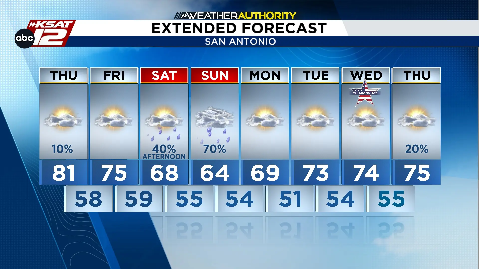
Extended Forecast
(Copyright KSAT-12 2026 – All Rights Reserved)