
FORECAST HIGHLIGHTS
FORECAST
DRY START BEFORE RAIN ARRIVES
If you have outdoor plans Saturday morning or around midday, the weather should cooperate. Keep an eye on the sky though, scattered showers are possible after 2 p.m. Depending on your location, temperatures will range from the low 60s in the northwest to the mid-70s in the south and east. Be sure to check the radar before you head out!
Weekend outlook (Copyright KSAT-12 2026 – All Rights Reserved)
COOL, CLOUDY & RAINY SUNDAY
Sunday is shaping up to be a classic late-autumn rain day across South Central Texas. Expect overcast skies, cooler temps, and widespread rain. While most will be light to moderate, watch for occasional heavier downpours and minor ponding in urban areas. Stay warm and safe!
RAINFALL TOTALS THROUGH MONDAY
We’re tracking some much-needed rain moving into the area! Expect widespread totals of 1–3 inches, with some spots potentially seeing up to 5 inches. Unlike the intense downpours we typically see in the spring and summer, this rain will be spread out over several days, which should help keep flooding risks lower.
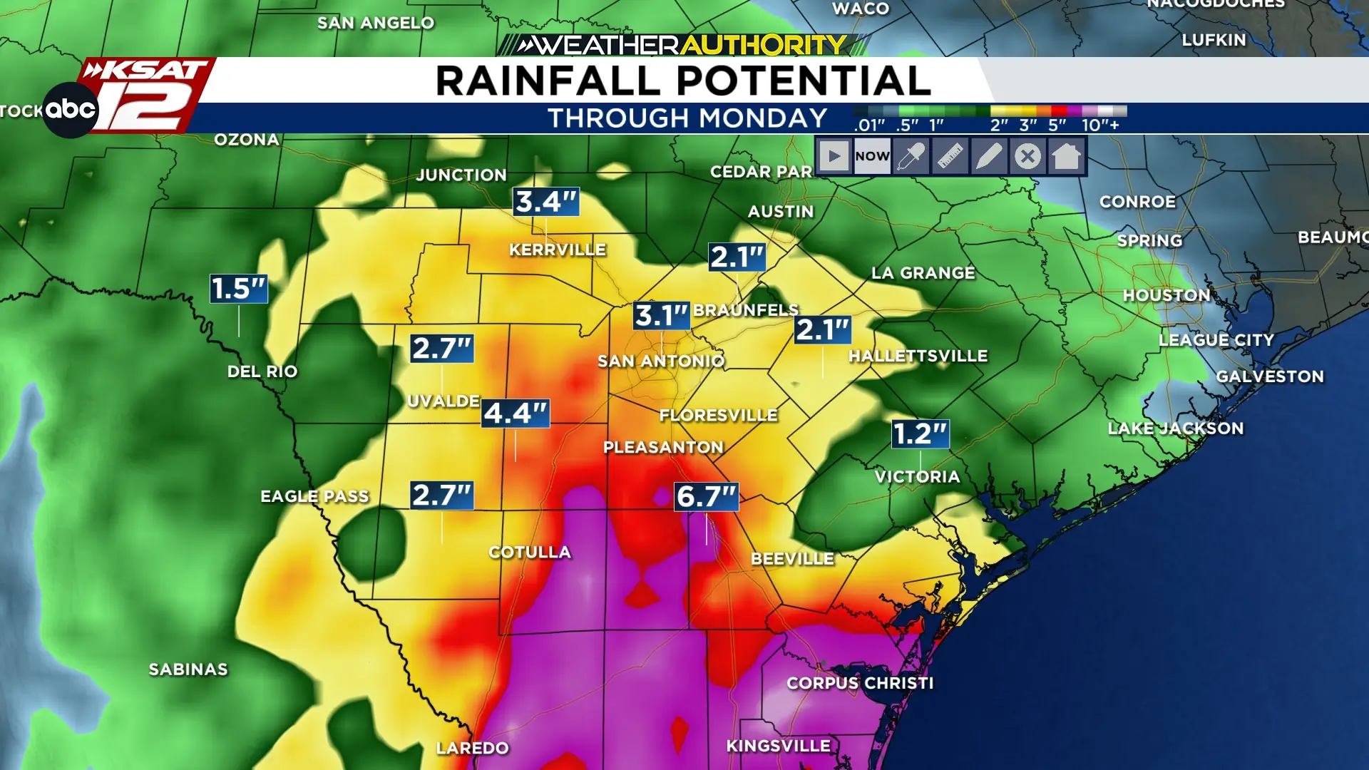
Widespread 1″-3″ likely with localized amounts of 5″ or more possible over the span of a few days. (Copyright KSAT-12 2026 – All Rights Reserved)
RAIN CONTINUES INTO NEXT WEEK
Expect steady rain and showers through Monday, with potential localized flooding. It will be cool and dreary, with highs in the 50s and 60s. Conditions improve Tuesday, with clearing skies and temperatures rebounding into the 70s.