
FORECAST HIGHLIGHTS
FORECAST
Hope you had a good Halloween! We gained an hour overnight with the end of Daylight Saving Time. The sun will set an hour earlier today, at 5:47 pm.
TODAY
You’ll notice high, thin cirrus clouds today and a bit of humidity. Otherwise, it’ll be warm-ish with a high in the low-80s.
MONDAY NIGHT INTO TUESDAY
Monday’s weather will be similar: Muggy and warm. But, Monday night into Tuesday morning, a cool front will sweep across Texas. This will bring severe storms to North Texas and Oklahoma.
Here, in South Central Texas, we’ll be on the tail-end of the system, meaning our storm chance is lower. Still, across the Hill Country and toward the Rio Grande, a broken line of storms will move through from 11 pm Monday to 5 am Tuesday. Along this line, there is a low-end threat for 60-70 mph gusts.
MONDAY NIGHT: A brief line of storms could bring 60-70 mph gusts in isolated cases. (Copyright 2026 by KSAT – All rights reserved.)
The leftover storms along the front will move through San Antonio early Tuesday, meaning we have a chance for a damp Tuesday morning commute and a few storms at the start of Election Day.
The front will quickly move through, gradually clearing skies, dropping humidity, and making it windy.
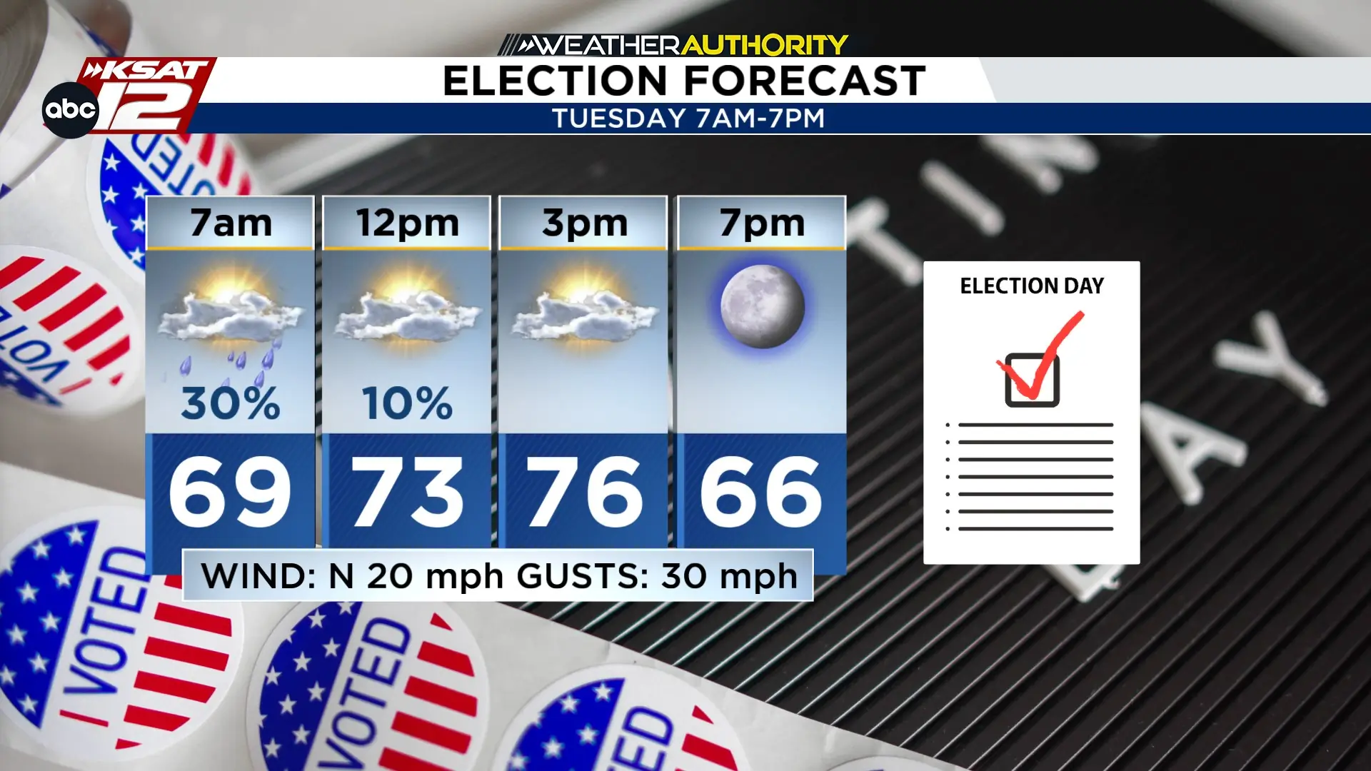 There will be a brief window for storms in the morning, but the front will bring in windy, drier weather most of Tuesday (Copyright 2026 by KSAT – All rights reserved.)
Behind the front, the rest of the week will be pleasant! We’ll have mornings in the 50s, afternoons in the 70s, and low humidity.