
FORECAST HIGHLIGHTS
FORECAST
TODAY — GENERALLY QUIET
Temperatures will soar again today into the mid-90s, accompanied by humidity and partly cloudy skies. While most areas will remain dry, a shower can’t be ruled out this afternoon, especially east of I-35.
WEDNESDAY (9/30) — STORMS OUT WEST
Wednesday marks a transition day as a storm system moves into Texas. Expect a few showers on Wednesday morning along the Rio Grande. By the afternoon, storms will likely develop west of San Antonio along a slow-moving front. Some of these storms could become strong to severe, with heavy rainfall posing a significant threat as they progress eastward.
Future radar for Wednesday night (9/30) at 9pm. (Copyright KSAT-12 2026 – All Rights Reserved)
THURSDAY (10/1) — HEAVY RAIN LIKELY
On Thursday, the front will slowly move toward San Antonio, making storms almost a certainty by the afternoon. The risks include heavy rainfall and potential street flooding. With abundant moisture and storm training, isolated areas could see rainfall exceeding 6 inches, while most will experience totals ranging from 2 to 5 inches.
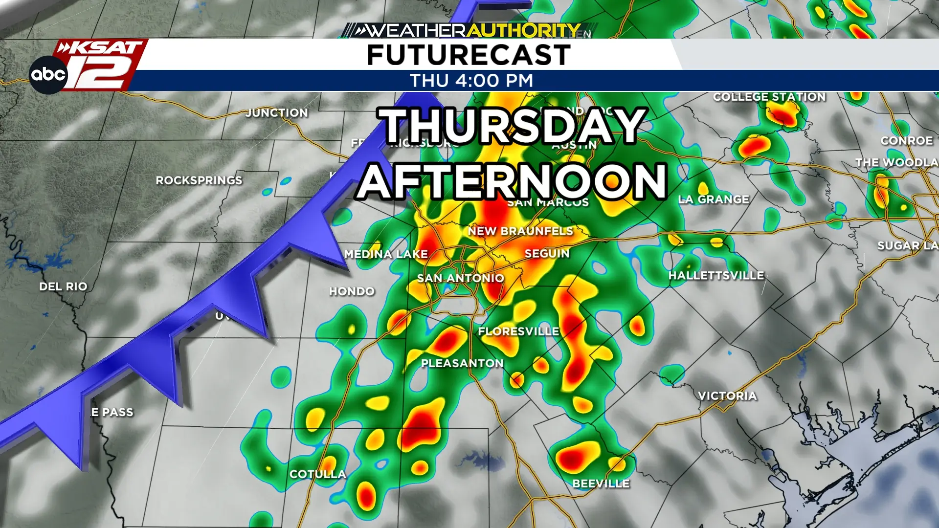 Future radar for Thursday afternoon (10/1) at 4pm (Copyright KSAT-12 2026 – All Rights Reserved)

