
FORECAST HIGHLIGHTS
FORECAST
TODAY
AM showers, mostly cloudy afternoon, and a high near 67°.
As our low finally exits east, a few lingering showers are possible this morning. Expect spotty, isolated rain through midday, with quieter conditions this afternoon. Skies will remain mostly cloudy, while temperatures stay in the 60s most of the day. This prolonged rain event has brought much-needed, soaking rains to the area. Check out the latest updated rainfall totals (as of 4:30am Tuesday):
72-hour rainfall totals as of 4:30am (11/10) (Copyright KSAT-12 2026 – All Rights Reserved)
SUNSHINE RETURNS
Clouds are forecast to hold for the first half of Wednesday; however, the sun should make a return late in the day. That’ll push temps into the 70s. Low humidity punches in on Thursday and Friday, giving us sunny skies both days.
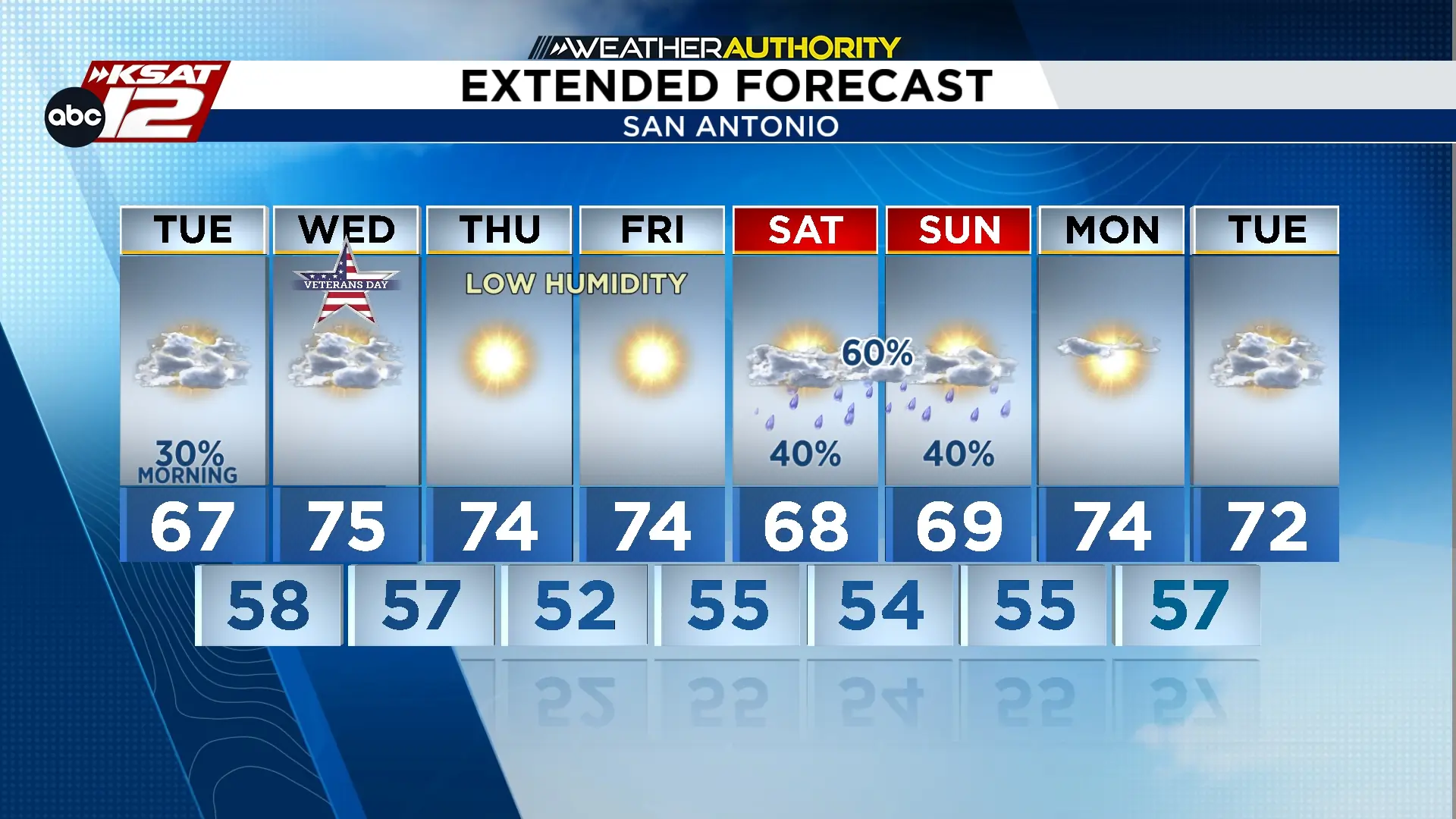 Extended Forecast (Copyright KSAT-12 2026 – All Rights Reserved)
WEEKEND UPDATE
A storm system will push into Texas again this weekend. The timeline has sped up slightly, with higher chances for rain arriving as early as Saturday afternoon. That rain chance will continue into Saturday night and Sunday morning. This does NOT appear to be “rainout” for the entire weekend. Check back with us, as we should have more clarity on specific timing in the coming days.