
WATCH LIVE RADAR ABOVE
FORECAST HIGHLIGHTS
FORECAST
WIDESPREAD RAIN
While the steadiest rainfall initially developed south of San Antonio, rain coverage will continue to expand. Expect heavier showers and a few thunderstorms to occasionally enhance rainfall rates, leading to pockets of accumulation.
Beneficial rain becoming widespread all day Sunday
(Copyright KSAT-12 2026 – All Rights Reserved)
COOL, WET, DREARY THROUGH MONDAY
Most areas should see 1 to 3 inches of beneficial rainfall through Monday evening, with a few areas potentially receiving 5 inches where multiple rounds occurred. This is shaping up to be one of the more widespread rain events the region has experienced in recent months.
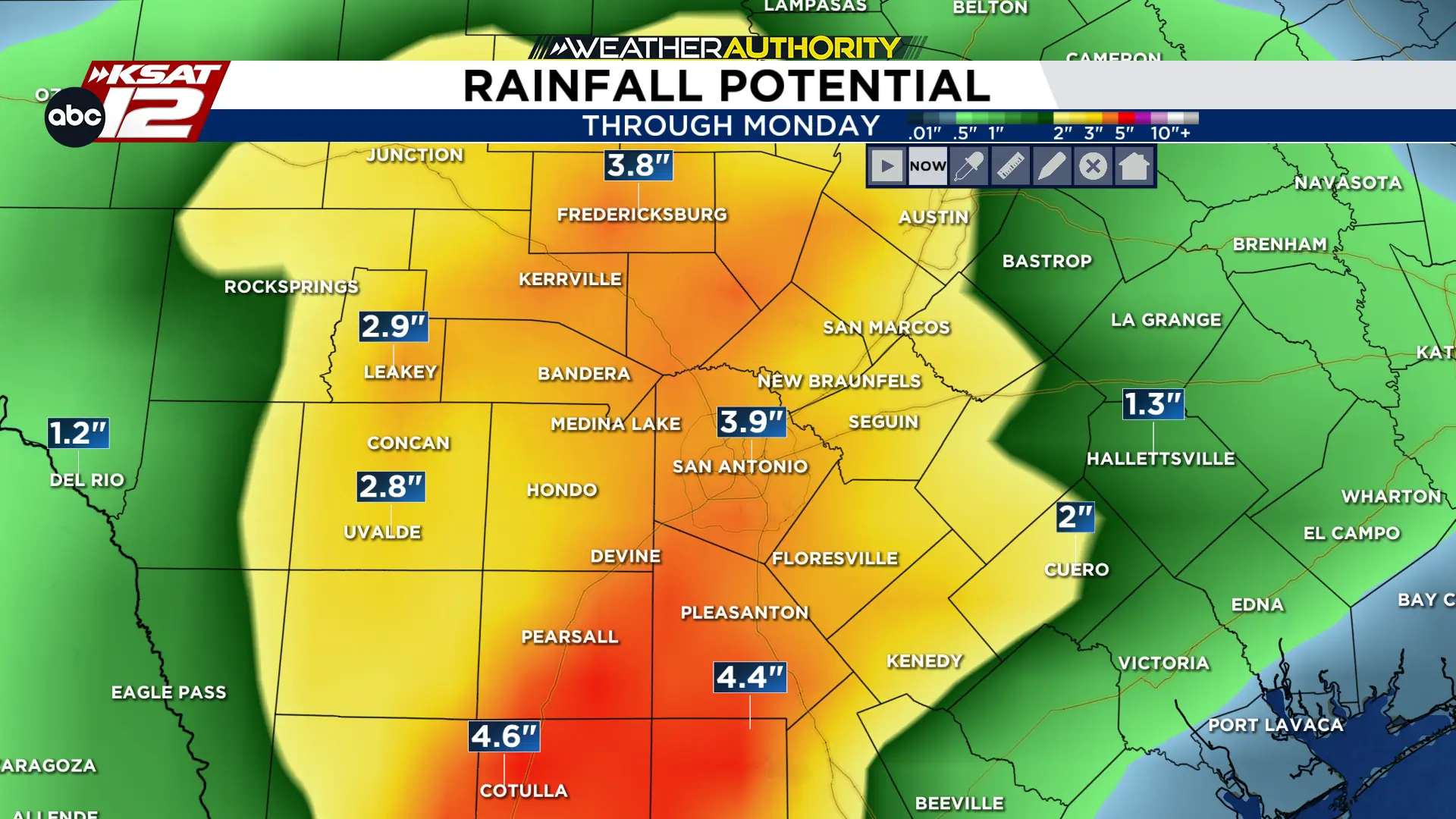
Rainfall totals expected through Monday
(Copyright KSAT-12 2026 – All Rights Reserved)
Expect a damp, gray stretch through Monday with intermittent rain and occasional downpours. Temperatures will remain cool, with highs in the mid-50s to low 60s, paired with persistent cloud cover.
NEXT WEEK
The storm system exits Tuesday with lingering showers east of I-35. Drier air arrives Wednesday as a cold front brings sunshine and highs in the 70s. Expect cooler mornings late in the week, with temperatures potentially dropping into the 40s.