
FORECAST HIGHLIGHTS
FORECAST
ANOTHER CRISP FALL MORNING
Keep your light jackets handy for Sunday morning as crisp, cool air brings a chilly start to South Central Texas. Lows will dip into the 40s across the Hill Country and I-35 corridor, marking the coolest morning of our current fall stretch. Conditions will rebound beautifully by the afternoon with abundant sunshine, highs in the 70s, and light winds—perfect for enjoying the comfortable weather.
Sunday Afternoon Planner (Copyright KSAT-12 2026 – All Rights Reserved)
NOT AS COLD MORNINGS
The coldest mornings are about to come to an end. Southerly return flow begins Sunday night, while some clouds increase across the area. That combination should keep temperatures from falling quite as much, with overnight lows generally returning to the 50s and 60s.
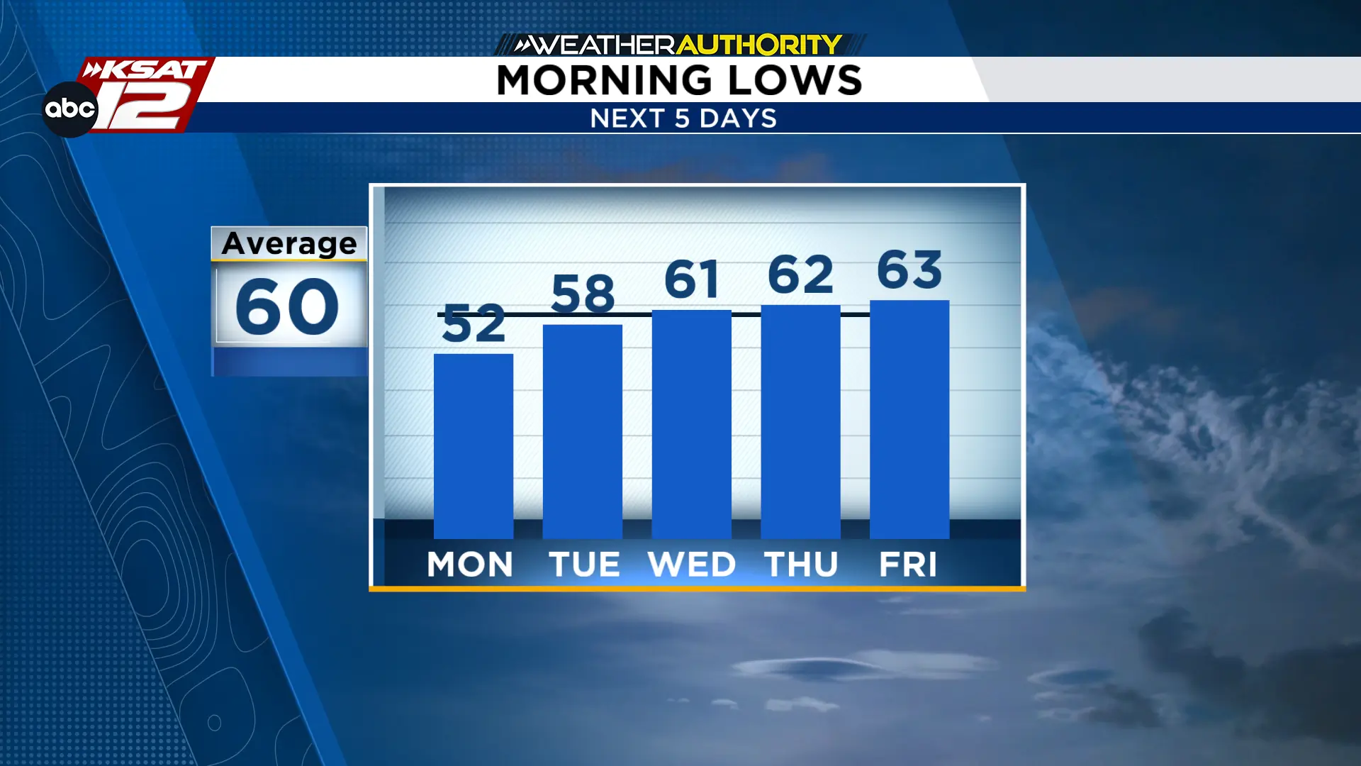 Mornings continue to be comfortable near average (Copyright KSAT-12 2026 – All Rights Reserved)
EXTENDED OUTLOOK
Temperatures will climb throughout the week, shifting from the 80s to near 90 by Friday as humidity returns. Despite a western weather system, high pressure will keep South Central Texas dry with no rain in the forecast.

