
FORECAST HIGHLIGHTS
FORECAST
SPOTTY STORMS MONDAY & TUESDAY
Sunday brought a nice round of rainfall to the Hill Country. Leftover moisture and boundaries should be enough to kick off isolated downpours this afternoon. Rain chances sit at 20% in San Antonio, with slightly higher odds in the Hill Country.
A weak front will wash out across the area tomorrow. It will not cool us down, but it could stir up another round of isolated rainfall on Tuesday.
Spotty, afternoon downpours are possible Monday and Tuesday (Copyright KSAT-12 2026 – All Rights Reserved)
FALL BEGINS
Technically, Fall begins tomorrow at 7:05PM. What does that mean? Not a whole lot. Temperatures remain well-above average through the weekend. This increases our odds of finishing with the hottest September in San Antonio’s recorded history.
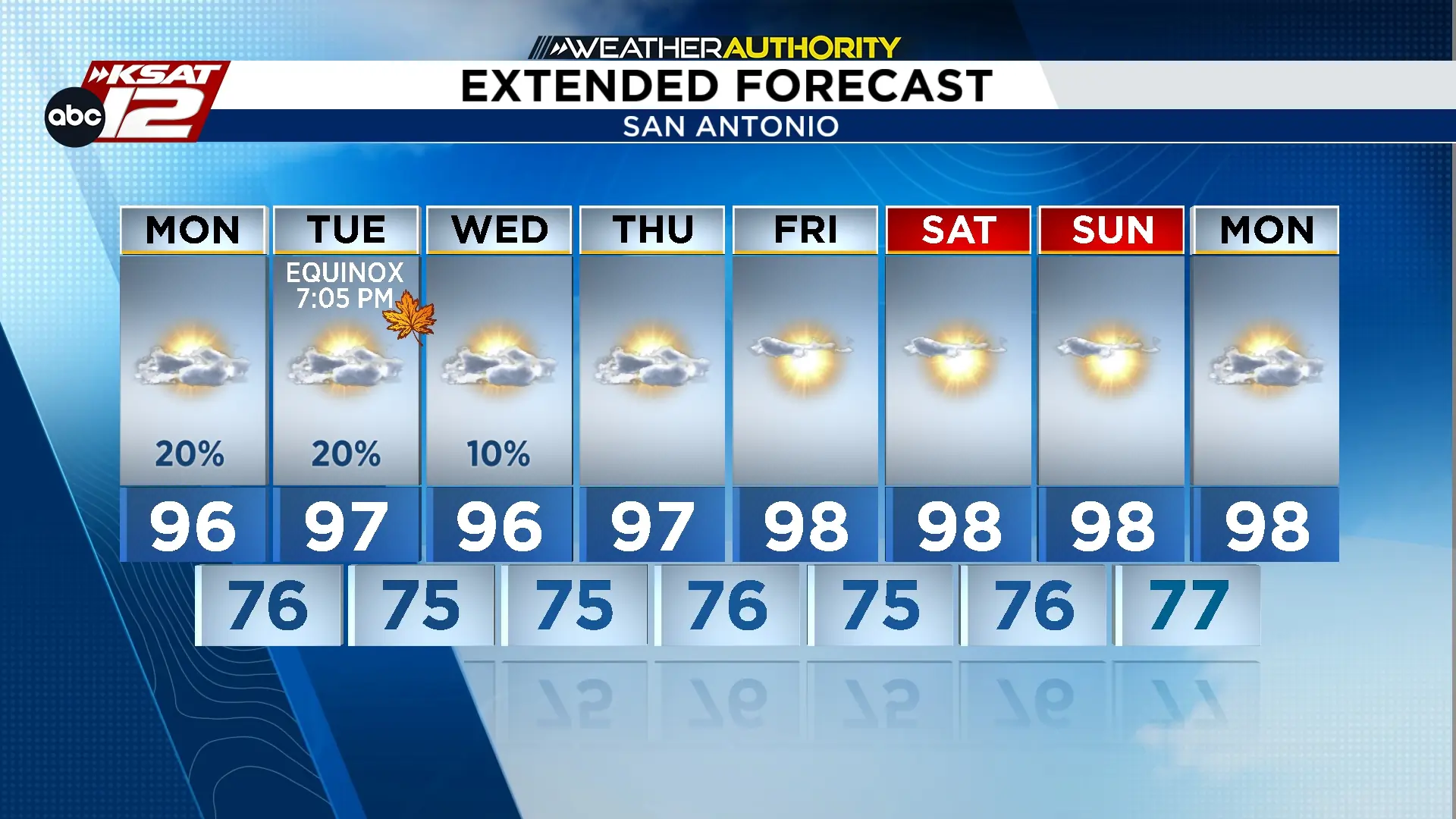
Extended Forecast (Copyright KSAT-12 2026 – All Rights Reserved)
ANY RELIEF?
The models are hinting at a front next week. However, we’ve been down this road before and fronts tend to tease us this time of year. So, we’ll be cautiously optimistic. Check back later this week for an update!

