FORECAST HIGHLIGHTS
FORECAST
WEEKEND FORECAST
This weekend is shaping up to be particularly hot, with Saturday expected to be the hottest day of the forecast period. A Heat Advisory is currently in effect from noon through 7 p.m. Saturday for areas generally along and east of the I-35 corridor, emphasizing the need for residents to stay hydrated and avoid strenuous outdoor activities during peak heat hours.
SWEAT-tember continues!
(Copyright KSAT-12 2026 – All Rights Reserved)
While the majority of the region will remain dry, isolated showers or thunderstorms may develop Saturday afternoon, particularly along the Coastal Plains and near the Highway 77 corridor. However, the chances for significant rainfall are low for areas farther north toward the I-35 corridor and Hill Country. Meteorologists will continue to monitor the weather trends throughout the day.
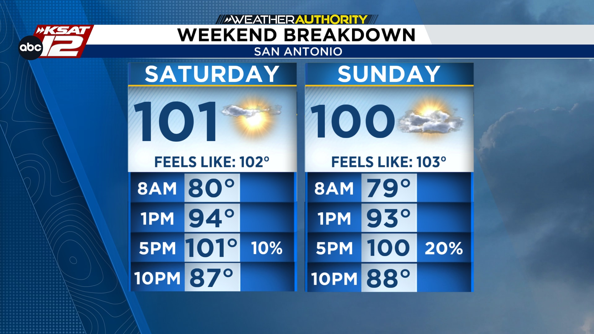
Hot with a few coastal showers
(Copyright KSAT-12 2026 – All Rights Reserved)
On Sunday, temperatures will see a slight dip, but it will still be very hot across the region. Heat index values could once again approach advisory levels, particularly east of I-35 toward the Coastal Plains. A few spotty showers or storms are possible in the afternoon, providing some relief but also maintaining a risk for localized flooding in areas that receive rainfall.
NEXT WEEK
Looking ahead, cooler weather is unfortunately not on the immediate horizon. High pressure will dominate the weather pattern through much of next week, ensuring that skies remain mostly clear and temperatures stay well above seasonal averages. While a few late-afternoon showers or thunderstorms may develop, especially near the Coastal Plains, most locations are expected to stay dry. Residents should continue to prepare for sustained heat as the season transitions.
The changing of the seasons will come eventually, but for now, South Texas residents will need to be patient as summer-like conditions persist.
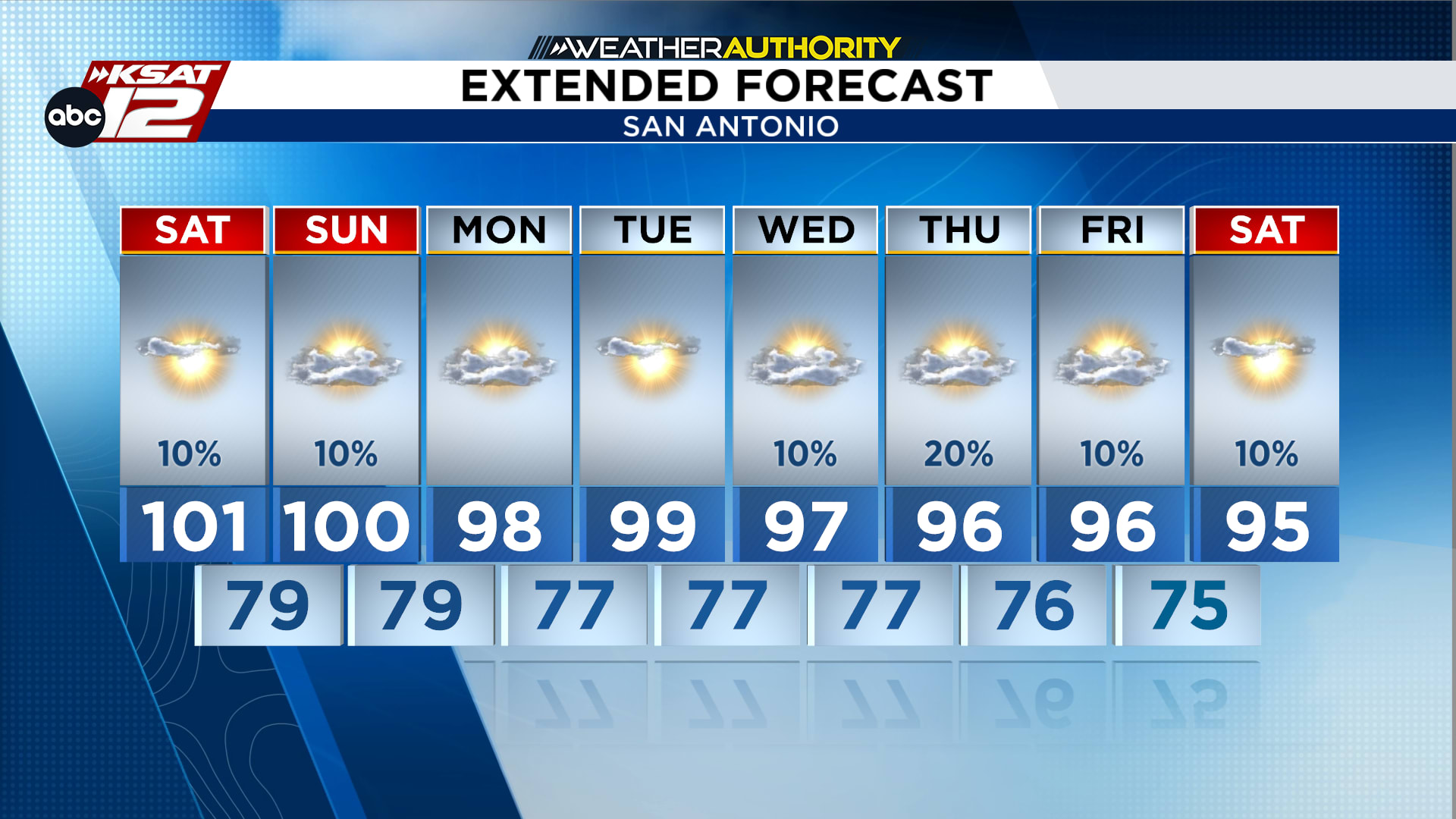
Extended Forecast
(Copyright KSAT-12 2026 – All Rights Reserved)
Daily Forecast